



By Miriam Humbe
The Federal Capital Territory Administration (FCTA), in collaboration with the National Emergency Management Agency, NEMA and other relevant emergency management and technical agencies, has conducted a joint assessment of flash flood-prone locations across the Territory following the recent flooding incident along the Lugbe Airport Road axis, opposite Glory Dome.
Nkechi Isa, the FEMD’s Head Public Affairs disclosed this in a statement signed on Friday.
The assessment tour, which took place on September 1, 2026, was led by the Executive Secretary, Federal Capital Development Authority (FCDA) and involved officials of the FCT Emergency Management Department (FEMD), Department of Engineering, Development Control and the National Emergency Management Agency (NEMA).
The exercise was aimed at identifying the causes of flash flooding in affected locations, assessing the condition and capacity of drainage and bridge infrastructure, and recommending appropriate measures to reduce flood risks across the FCT.
At the reported flash flood location along Lugbe Airport Road, opposite Glory Dome, the assessment team observed that the estate located behind Trademore Estate has inadequate drainage infrastructure.
Following the heavy rainfall recorded on September 1, stormwater from the estate flowed towards the Airport Expressway, resulting in flooding and causing serious traffic congestion.
The team also visited Trademore Estate, where no active flooding was observed during the assessment.
The water level in the adjoining water channel was within normal limits at the time of the visit.
At Dogongada Bridge in Lokogoma, no active flooding was recorded during the inspection.
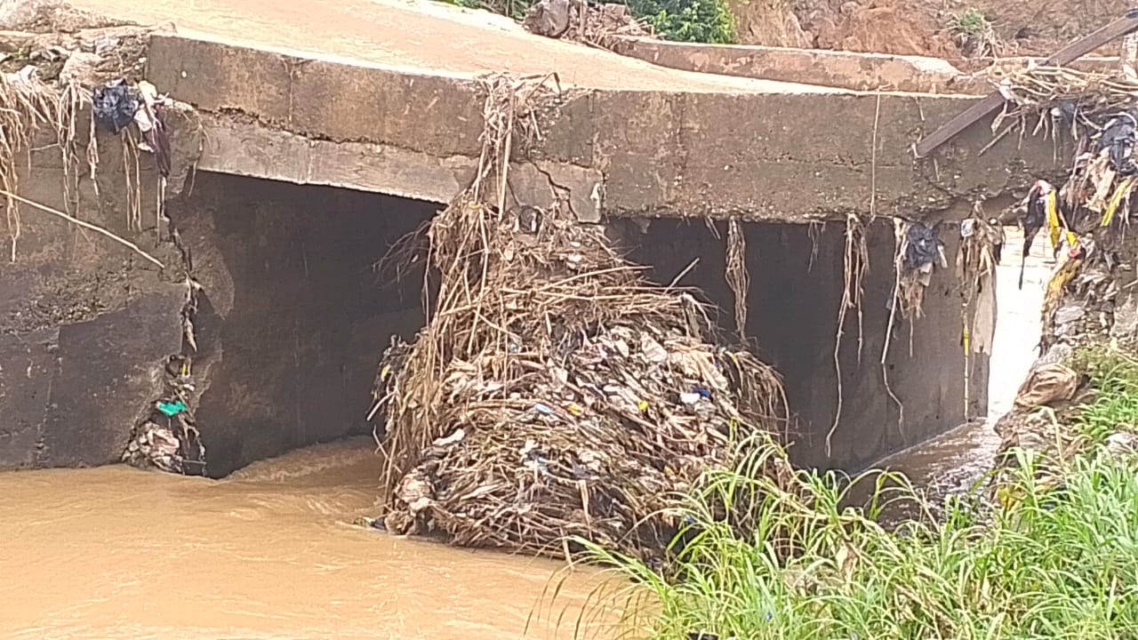
However, the team observed that the existing bridge was inadequate to accommodate large volumes of storm water during heavy rain fall and was at risk of structural failure.
At Efab Estate, flash flooding in some sections was attributed to the diversion of natural waterways, as well as inadequate standard drainage infrastructure.
Similarly, no active flooding was observed at Pengason Estate during the assessment.
However, the bridge in the area was found to have limited capacity to convey large volumes of stormwater during heavy rainfall and was identified as requiring expansion.
At Apo, behind Cedarcrest Hospital, the assessment team observed ongoing construction of retaining walls along a water channel.
The construction had narrowed the available waterway, restricting the free flow of stormwater and increasing the risk of flash flooding during heavy rainfall.
The team further observed that a house constructed very close to the water channel had been demolished by the Department of Development Control.
At the Apo Bridge, after Cedarcrest Hospital, the team observed that the existing bridge has inadequate capacity to effectively convey large volumes of stormwater during heavy rainfall.
The surrounding area also lacks adequate standard drainage system, thereby increasing its vulnerability to flooding.
Following the assessment, the team recommended immediate intervention at locations where bridges and drainage structures are inadequate or at risk of failure.
It also called for the provision of standard drainage systems in estates and communities experiencing recurrent flooding.
The assessment team further emphasized the need to protect and restore natural waterways and flood channels by preventing encroachment, diversion and obstruction.
